The maps are accurately prepared by a GIS and remote sensing expert.
Browse 60+ paterson new jersey illustrations stock illustrations and vector graphics available royalty-free, or start a new search to explore more great stock images and vector art.
The maps are accurately prepared by a GIS and remote sensing expert.
Downloadable county map of New Jersey state of United States of America. The map is accurately prepared by a map expert.
New Jersey, NJ, gray political map with capital Trenton. State in the Mid-Atlantic region of the Northeastern United States of America. The Garden State. Illustration on white background. Vector.
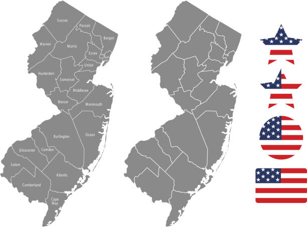
Highly detailed downloadable map of New Jersey counties state of United States of America for web banner, mobile, smartphone, iPhone, iPad applications and educational use. The map is accurately prepared by a map expert.
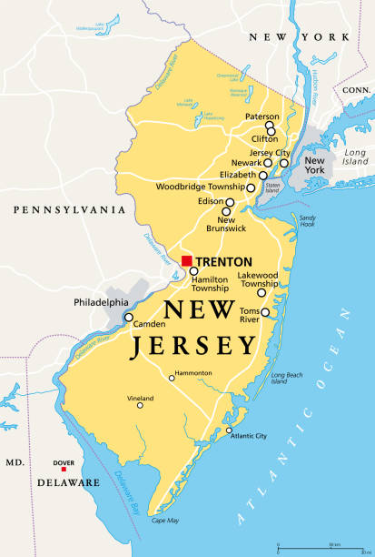
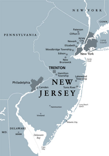
New Jersey, NJ, political map with capital Trenton. State in the Mid-Atlantic region of northeastern United States of America. The Garden State. Most densely populated US state. Illustration. Vector.

NJ Passaic County Vector Map Green. All source data is in the public domain. U.S. Census Bureau Census Tiger. Used Layers: areawater, linearwater, cousub, pointlm.

Accurate outline vector map in gray background prepared by a map expert.
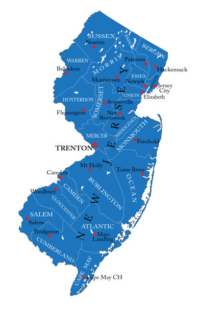
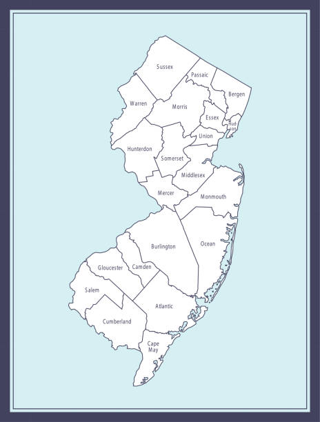
Detailed map of New Jersey state,in vector format,with county borders and major cities.

Vector Illustration of a Road Map of New Jersey State, USA. All source data is in the public domain. U.S. Geological Survey, US Topo Used Layers: USGS The National Map: National Hydrography Dataset (NHD) USGS The National Map: National Transportation Dataset (NTD)

Downloadable outline vector map of New Jersey state of United States of America. The map is accurately prepared by a map expert.

Printable outline vector map of New Jersey state of United States of America. The map is accurately prepared by a map expert.

Accurate outline vector map in gray background prepared by a map expert.

Highly detailed downloadable map of New Jersey county state of United States of America for web banner, mobile, smartphone, iPhone, iPad applications and educational use. The map is accurately prepared by a map expert.

Historical view of the Great Falls of the Passaic River - a prominent waterfall, 77 feet (23 m) high, on the Passaic River in the city of Paterson in Passaic County, New Jersey. The falls and surrounding area are protected as part of the Paterson Great Falls National Historical Park, administered by the National Park Service. One of the United States' largest waterfalls, it played a significant role in the early industrial development of New Jersey. It is part of the Great Falls of Paterson - Garret Mountain National Natural Landmark. It has also been designated as a National Historic Landmark District since 1976. The Great Falls' raceway and power systems were designated a National Historic Civil Engineering Landmark and a National Historic Mechanical Engineering Landmark in 1977. Halftone print after a photograph, published in 1899.

Paterson NJ City Vector Road Map Blue Text. All source data is in the public domain. U.S. Census Bureau Census Tiger. Used Layers: areawater, linearwater, roads.

Cartoon Map of New Jersey https://maps.lib.utexas.edu/maps/united_states/fed_lands_2003/new_jersey_2003.pdf

Map of Passaic County - New Jersey, with a realistic paper cut effect isolated on white background. Trendy paper cutout effect. Vector Illustration (EPS file, well layered and grouped). Easy to edit, manipulate, resize or colorize. Vector and Jpeg file of different sizes.

Map of Passaic County - New Jersey, on two blue and red rubber stamps. Two versions included in the bundle: - One blue stamp with the map in the middle and the word "Democrat" around. - One red stamp with the map in the middle and the word "Republican" around. And also two blue and red banners with the name of the county. Vector Illustration (EPS file, well layered and grouped). Easy to edit, manipulate, resize or colorize. Vector and Jpeg file of different sizes.

Paterson City, New Jersey (United States cities, United States of America, usa city) map vector illustration, scribble sketch City of Paterson map

Accurate outline vector map in gray background prepared by a map expert.

Accurate outline vector map in gray background prepared by a map expert.

Printable map of New Jersey state of United States of America. The map is accurately prepared by a map expert.

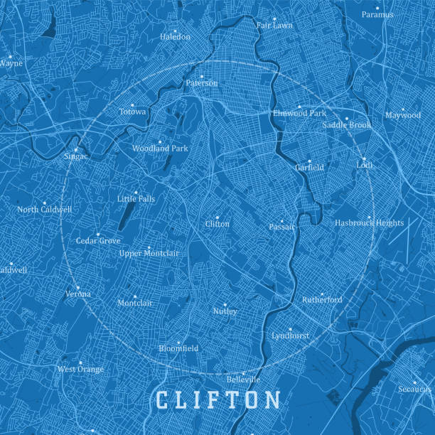
Topographic / Road map of Paterson, NJ. Map data is public domain via census.gov. All maps are layered and easy to edit. Roads are editable stroke.

Map of Passaic County - New Jersey, on a blue and red colored background. The blue color represents the Democratic Party and the red color represents the Republican Party. White stars are placed above and below the map. Vector Illustration (EPS file, well layered and grouped). Easy to edit, manipulate, resize or colorize. Vector and Jpeg file of different sizes.

Topographic / Road map of Paterson, NJ. Map data is public domain via census.gov. All maps are layered and easy to edit. Roads are editable stroke.

Maps of Passaic County - New Jersey, on blue and red backgrounds. Four map versions included in the bundle: - One map on a blank blue background. - One map on a blue background with the word "Democrat". - One map on a blank red background. - One map on a red background with the word "Republican". Vector Illustration (EPS file, well layered and grouped). Easy to edit, manipulate, resize or colorize. Vector and Jpeg file of different sizes.

Topographic / Road map of Paterson, NJ. Map data is public domain via census.gov. All maps are layered and easy to edit. Roads are editable stroke.

Map of Passaic County - New Jersey, in a trendy vintage style. Beautiful retro illustration with old textured paper and light rays in the background (colors used: blue, green, beige and black for the outline). Vector Illustration (EPS file, well layered and grouped). Easy to edit, manipulate, resize or colorize. Vector and Jpeg file of different sizes.

Topographic / Road map of Paterson, NJ. Map data is public domain via census.gov. All maps are layered and easy to edit. Roads are editable stroke.

Topographic / Road map of Paterson, NJ. Map data is public domain via census.gov. All maps are layered and easy to edit. Roads are editable stroke.

Map of Passaic County - New Jersey, with a large group of people. The faces are blue and red and represent patriots. The color blue for the Democratic Party and the color red for the Republican Party. Conceptual creative map, can symbolize the unity, cooperation, teamwork, patriotism... Vector Illustration (EPS file, well layered and grouped). Easy to edit, manipulate, resize or colorize. Vector and Jpeg file of different sizes.

Map of Passaic County - New Jersey, isolated on a blank background and with his name on a red ribbon. Vector Illustration (EPS file, well layered and grouped). Easy to edit, manipulate, resize or colorize. Vector and Jpeg file of different sizes.

Accurate outline vector map in gray background prepared by a map expert.

Paterson City, New Jersey (United States cities, United States of America, usa city) map vector illustration, scribble sketch City of Paterson map

Cartoon Map of New Jersey https://maps.lib.utexas.edu/maps/united_states/fed_lands_2003/new_jersey_2003.pdf

3D Map of Passaic County - New Jersey, isolated on a blank and gray background, with a dropshadow. Vector Illustration (EPS file, well layered and grouped). Easy to edit, manipulate, resize or colorize. Vector and Jpeg file of different sizes.

Highly detailed downloadable map of New Jersey state of United States of America for web banner, mobile, smartphone, iPhone, iPad applications and educational use. The map is accurately prepared by a map expert.

Highly detailed downloadable map of New Jersey state of United States of America for web banner, mobile, smartphone, iPhone, iPad applications and educational use. The map is accurately prepared by a map expert.

Paterson City, New Jersey (United States cities, United States of America, usa city) map vector illustration, scribble sketch City of Paterson map

Map of Passaic County - New Jersey, for your own design. Four maps with editable stroke included in the bundle: - One black map on a white background. - One blank map on a black background. - One white map with shadow on a blank background (for easy change background or texture). - One line map with only a thin black outline (in a line art style). The layers are named to facilitate your customization. Vector Illustration (EPS file, well layered and grouped). Easy to edit, manipulate, resize or colorize. Vector and Jpeg file of different sizes.

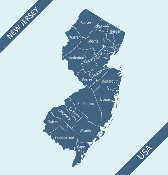
Printable counties map of New Jersey state of United States of America. The map is accurately prepared by a map expert.

Topographic / Road map of Paterson, NJ. Map data is public domain via census.gov. All maps are layered and easy to edit. Roads are editable stroke.

Topographic / Road map of Paterson, NJ. Map data is public domain via census.gov. All maps are layered and easy to edit. Roads are editable stroke.

Two men traveling by stagecoach, riding on the top in Passaic County, New Jersey, United States of America (circa mid 19th century). Vintage etching circa mid 19th century.
Clifton NJ City Vector Road Map Blue Text. All source data is in the public domain. U.S. Census Bureau Census Tiger. Used Layers: areawater, linearwater, roads.
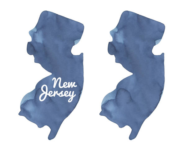
Hand painted water colour drawing, cut out clip art elements for design.

Cartoon Map of New Jersey https://maps.lib.utexas.edu/maps/united_states/fed_lands_2003/new_jersey_2003.pdf

The Great Falls of the Passaic River in Paterson, New Jersey, United States of America (circa mid 19th century). Vintage etching circa mid 19th century.
© 2025 iStockphoto LP. The iStock design is a trademark of iStockphoto LP. Browse millions of high-quality stock photos, illustrations, and videos.
Do Not Sell or Share


