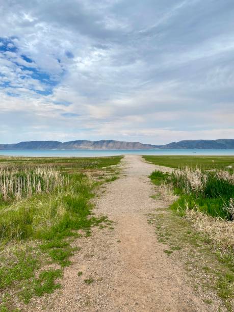
This is a view to Bear Lake which stretches between southern Idaho and northern Utah. Because of its aquamarine waters caused by dissolved limestone, it has been called the "Caribbean of the Rockies." This view shows the flowers and grasses that grow in the surrounding mountains which have a short summer season. High butterfly density when I visited. Tucked against the bottom edge of the lake in this view is the town of Garden City, Utah which is the center of human activity around the lake during the summer months.
Bear Lake Utah Pictures, Images and Stock Photos
Browse 120+ bear lake utah stock photos and images available, or search for park city utah or lake powell to find more great stock photos and pictures.
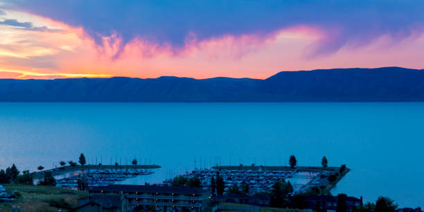
This is the morning view from our "cabin" in Garden City, Utah which overlooked Bear Lake. Cabin is kind of a misnomer. It was actually a three-level condo which fit twelve of us. It seems Bear Lake tradition calls for lots of people to share large rental houses and condos and call them cabins. Our rented cabin had some gorgeous views of the lake from our balconies, including the marina from which most of the sailboats launched. Very calm waters early in the morning.
Along with all the motorized watersports that happen on Bear Lake, there is also a lot of paddleboarding and kayaking. This shot shows a woman paddleboarding just off the North Shore beach area of the lake. This was still fairly early in the morning so the very blue water was quite calm. Taken with a camera inside a waterproof case so I could get a very low angle to the water.
3D Render of a Topographic Map of Bear Lake, Idaho and Utah, USA. All source data is in the public domain. Contains modified Copernicus Sentinel data (Aug 2019) courtesy of ESA. URL of source image: https://scihub.copernicus.eu/dhus/#/home. Relief texture SRTM data courtesy of NASA. URL of source image: https://search.earthdata.nasa.gov/search/granules/collection-details?p=C1000000240-LPDAAC_ECS&q=srtm%201%20arc&ok=srtm%201%20arc