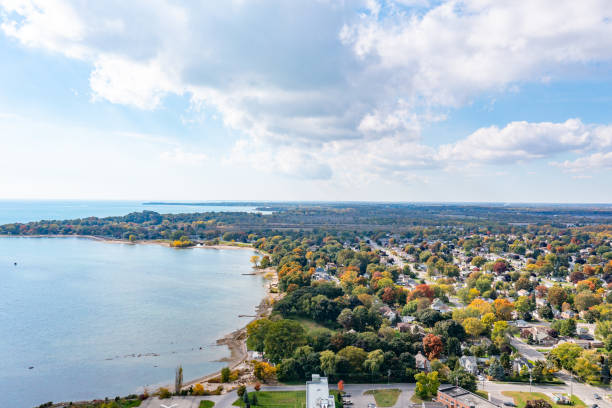
View of the Cleveland area coastline with Lake Erie on the left, city/suburb of Lakewood in the foreground, and Cleveland skyline in the far distance.
Browse 1,500+ lake erie aerial stock photos and images available, or start a new search to explore more stock photos and images.
View of the Cleveland area coastline with Lake Erie on the left, city/suburb of Lakewood in the foreground, and Cleveland skyline in the far distance.
Cars come and go at sunrise before rush hour in Clevland Ohio on Lake Erie

aerial view of the Bass Islands, Lake Erie; Put-in-Bay on South Bass Island in the foreground, Ohio USA

"aerial view of Pelee Island, Southern Ontario, Canada during Fall"
Drone shot of Presque Isle in Erie PA

"aerial view of Put in Bay's marina and Perry's Victory & International Peace Memorial, Put-in-Bay South Bass island Ohio USA"

3D Render of a Topographic Map of Lake Ontario. All source data is in the public domain. Color texture: Made with Natural Earth. http://www.naturalearthdata.com/downloads/10m-raster-data/10m-cross-blend-hypso/ Water texture: SRTM Water Body SWDB: https://dds.cr.usgs.gov/srtm/version2_1/SWBD/ Relief texture: 3DEP data courtesy of USGS The National Map. URL of source image: https://apps.nationalmap.gov/downloader/

aerial view of Port Dover, home of Friday the 13th biker meet; view from above the Lake Erie towards town; Ontario Canada

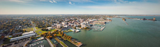
Aerial image of Willowick Ohio and Lake Erie

3D Render of a Topographic Map of Lake Erie. All source data is in the public domain. Color texture: Made with Natural Earth. http://www.naturalearthdata.com/downloads/10m-raster-data/10m-cross-blend-hypso/ Water texture: SRTM Water Body SWDB: https://dds.cr.usgs.gov/srtm/version2_1/SWBD/ Relief texture: 3DEP data courtesy of USGS The National Map. URL of source image: https://apps.nationalmap.gov/downloader/

Aerial view of Put-in-Bay Airport on South Bass Island, Ottawa County, Ohio, USA

3D Render of a Topographic Map of the State of Michigan, USA. All source data is in the public domain. Relief texture and Rivers: SRTM data courtesy of USGS. URL of source image: https://e4ftl01.cr.usgs.gov//MODV6_Dal_D/SRTM/SRTMGL1.003/2000.02.11/ Water texture: SRTM Water Body SWDB: https://dds.cr.usgs.gov/srtm/version2_1/SWBD/

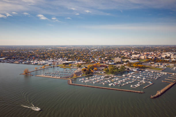
Aerial view of Sandusky, Ohio shoreline at sunset, on the Erie lake.

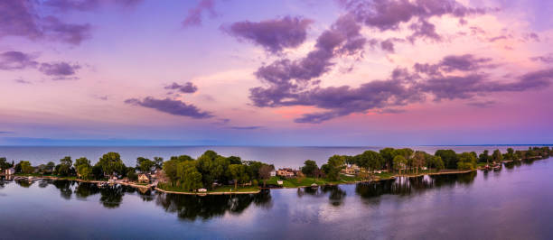
aerial vie of the village center at Long Point on the north shore of Lake Erie, part of Norfolk County in the province of Ontario, Canada.

aerial view of Put in Bay's Airport, Put in Bay Ohio USA

3D Render of a Topographic Map of Buffalo City, New York State and Niagara River. All source data is in the public domain. Color and Water texture: Contains modified Copernicus Sentinel data courtesy of ESA. URL of source image: https://dataspace.copernicus.eu/explore-data/data-collections/sentinel-data/sentinel-2 Relief texture: 3DEP data courtesy of USGS. URL of source image: https://apps.nationalmap.gov/downloader/#/

3D Render of a Topographic Map of Toledo, Ohio, USA. All source data is in the public domain. Contains modified Copernicus Sentinel data (Mar 2019) courtesy of ESA. URL of source image: https://scihub.copernicus.eu/dhus/#/home. Relief texture SRTM data courtesy of NASA. URL of source image: https://search.earthdata.nasa.gov/search/granules/collection-details?p=C1000000240-LPDAAC_ECS&q=srtm%201%20arc&ok=srtm%201%20arc
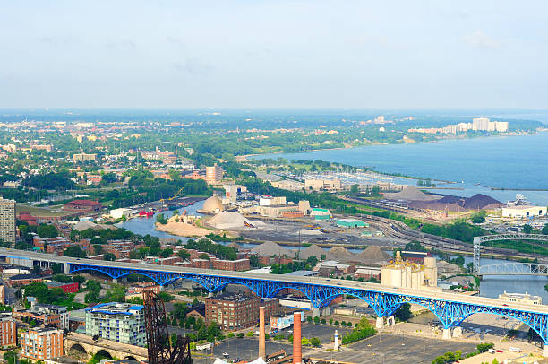
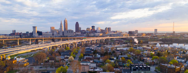
Aerial view of Cleveland Ohio looking west over the industrial Flats and Lake Erie shoreline

3D Render of a Topographic Map of Cleveland, Ohio, USA.

Aerial view of the lighthouse located on the tip of Long Point hamlet on the north shore of Lake Erie, part of Norfolk County in the province of Ontario, Canada

3D Render of a Topographic Map of Cleveland, Ohio, USA. All source data is in the public domain. Contains modified Copernicus Sentinel data (Sept 2019) courtesy of ESA. URL of source image: https://scihub.copernicus.eu/dhus/#/home. Relief texture SRTM data courtesy of NASA. URL of source image: https://search.earthdata.nasa.gov/search/granules/collection-details?p=C1000000240-LPDAAC_ECS&q=srtm%201%20arc&ok=srtm%201%20arc

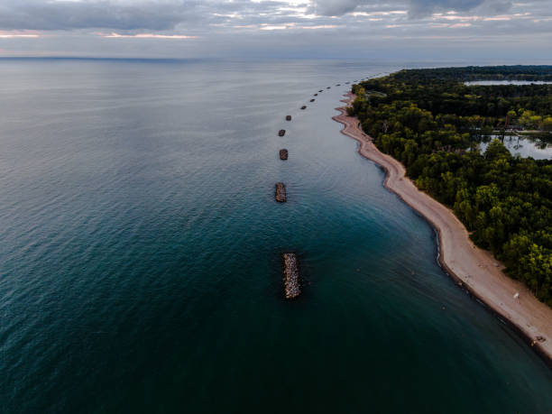
"aerial view along the Lake Erie Coast line, Rondeau National Park in the background, Ontario Canada"
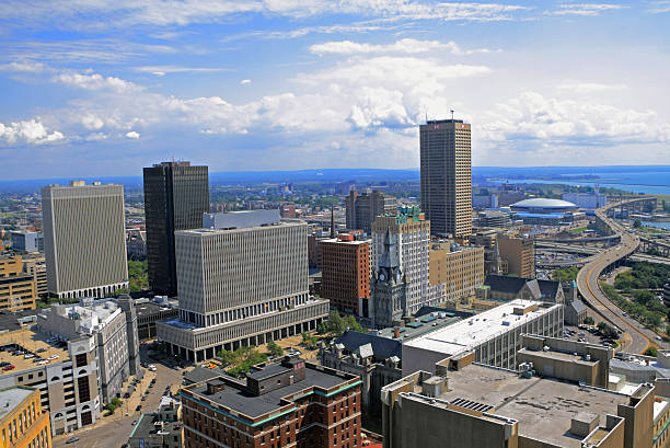
"Buffalo, USA - August 13, 2012: Buffalo Downtown and Waterfront landmarks and street views with Lake Erie in the background"
Aerial panorama of the Ceder Point peninsula at dusk, in Sandusky, Ohio, on the Erie lake.
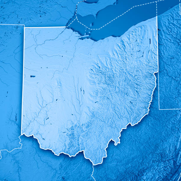
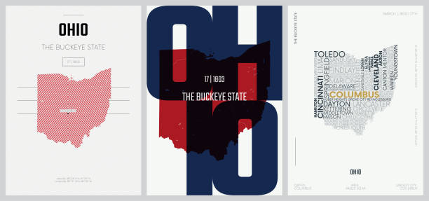
3D Render of a Topographic Map of the State of Ohio, USA. All source data is in the public domain. Boundaries Level 1: USGS, National Map, National Boundary Data. https://viewer.nationalmap.gov/basic/#productSearch Relief texture and Rivers: SRTM data courtesy of USGS. URL of source image: https://e4ftl01.cr.usgs.gov//MODV6_Dal_D/SRTM/SRTMGL1.003/2000.02.11/ Water texture: SRTM Water Body SWDB: https://dds.cr.usgs.gov/srtm/version2_1/SWBD/
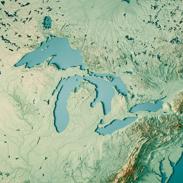
3D Render of a Topographic Map of the Great Lakes, USA and Canada. All source data is in the public domain. Color texture and Rivers: Made with Natural Earth. http://www.naturalearthdata.com/downloads/10m-raster-data/10m-cross-blend-hypso/ http://www.naturalearthdata.com/downloads/10m-physical-vectors/ Relief texture: SRTM data courtesy of USGS. URL of source image: https://e4ftl01.cr.usgs.gov//MODV6_Dal_D/SRTM/SRTMGL1.003/2000.02.11/ Water texture: HIU World Water Body Limits: http://geonode.state.gov/layers/?limit=100&offset=0&title__icontains=World%20Water%20Body%20Limits%20Detailed%202017Mar30
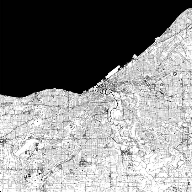
Topographic / Road map of Cleveland, Ohio . USA United States of America. Original map data is open data via © OpenStreetMap contributors. All maps are layered and easy to edit. Roads are editable stroke.

3D Render of a Topographic Map of the Great Lakes, USA and Canada. All source data is in the public domain. Color texture and Rivers: Made with Natural Earth. http://www.naturalearthdata.com/downloads/10m-raster-data/10m-cross-blend-hypso/ http://www.naturalearthdata.com/downloads/10m-physical-vectors/ Relief texture: SRTM data courtesy of USGS. URL of source image: https://e4ftl01.cr.usgs.gov//MODV6_Dal_D/SRTM/SRTMGL1.003/2000.02.11/ Water texture: HIU World Water Body Limits: http://geonode.state.gov/layers/?limit=100&offset=0&title__icontains=World%20Water%20Body%20Limits%20Detailed%202017Mar30

3D Render of a Topographic Map of Erie, Pennsylvania, USA. All source data is in the public domain. Contains modified Copernicus Sentinel data (Oct 2019) courtesy of ESA. URL of source image: https://scihub.copernicus.eu/dhus/#/home. Relief texture SRTM data courtesy of NASA. URL of source image: https://search.earthdata.nasa.gov/search/granules/collection-details?p=C1000000240-LPDAAC_ECS&q=srtm%201%20arc&ok=srtm%201%20arc
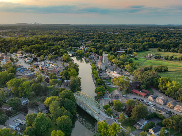
Pittsford, NY is located in Updated New York, southeast of Rochester, NY. Early evening aerial photo of Schoen Place and the Erie Canal in the Village of Pittsford, New York.
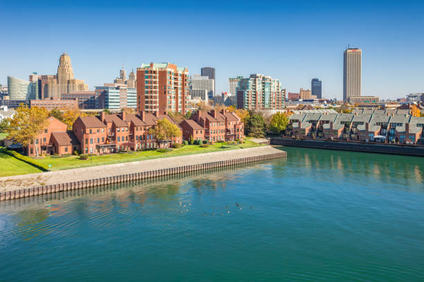
The waterfront and downtown Buffalo New York USA on a sunny day

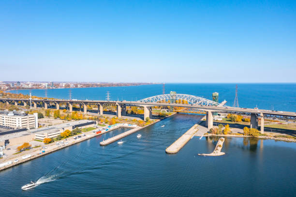
"aerial view of the Welland Canal, Lake Erie entrance; Port Colborne Ontario Canada"

3D Render of a Topographic Map of Toledo, Ohio, USA. All source data is in the public domain. Contains modified Copernicus Sentinel data (Mar 2019) courtesy of ESA. URL of source image: https://scihub.copernicus.eu/dhus/#/home. Relief texture SRTM data courtesy of NASA. URL of source image: https://search.earthdata.nasa.gov/search/granules/collection-details?p=C1000000240-LPDAAC_ECS&q=srtm%201%20arc&ok=srtm%201%20arc

aerial of Put-in-Bay island and Lake Erie

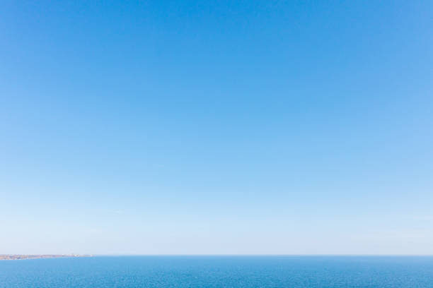
Aerial photo: scenic view. Flight over the Lake Erie, North America (USA - Canada).

3D Render of a Topographic Map of the State of Pennsylvania, USA. All source data is in the public domain. Color texture: Made with Natural Earth. http://www.naturalearthdata.com/downloads/10m-raster-data/10m-cross-blend-hypso/ Boundaries Level 1: USGS, National Map, National Boundary Data. https://viewer.nationalmap.gov/basic/#productSearch Relief texture and Rivers: SRTM data courtesy of USGS. URL of source image: https://e4ftl01.cr.usgs.gov//MODV6_Dal_D/SRTM/SRTMGL1.003/2000.02.11/ Water texture: SRTM Water Body SWDB: https://dds.cr.usgs.gov/srtm/version2_1/SWBD/

3D Render of a Topographic Map of the State of Michigan, USA. All source data is in the public domain. Boundaries Level 1: USGS, National Map, National Boundary Data. https://viewer.nationalmap.gov/basic/#productSearch Relief texture and Rivers: SRTM data courtesy of USGS. URL of source image: https://e4ftl01.cr.usgs.gov//MODV6_Dal_D/SRTM/SRTMGL1.003/2000.02.11/ Water texture: SRTM Water Body SWDB: https://dds.cr.usgs.gov/srtm/version2_1/SWBD/
© 2025 iStockphoto LP. The iStock design is a trademark of iStockphoto LP. Browse millions of high-quality stock photos, illustrations, and videos.
Do Not Sell or Share