Map of Colombia. Selective Focus.
Browse 230+ medellin map stock photos and images available, or start a new search to explore more stock photos and images.
Map of Colombia. Selective Focus.
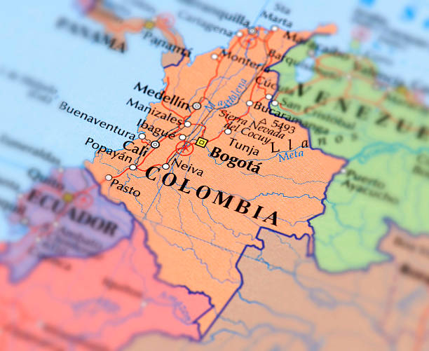
Political map of Colombia with capital Bogota, national borders, most important cities, rivers and lakes. Illustration with English labeling and scaling.

Map of Colombia. A detail from the World Map.

3d isometric map of Medellin is a city of Colombia, vector illustration
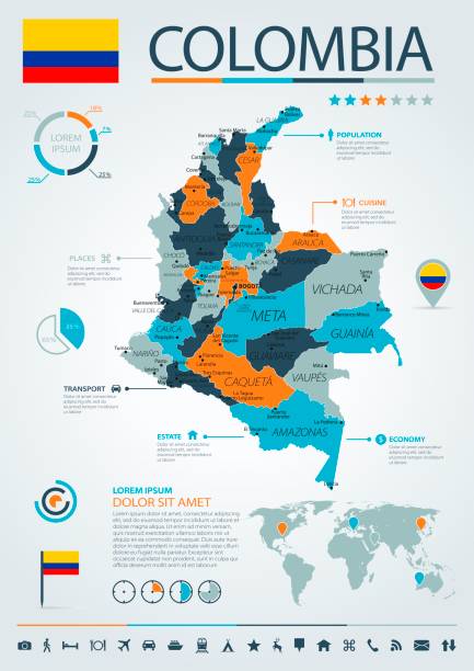
Map of Colombia - Infographic Vector illustration

Map of Colombia - Vintage Vector illustration

Colombia Map - Vintage High Detailed Vector Illustration

Map of Colombia - Vector illustration
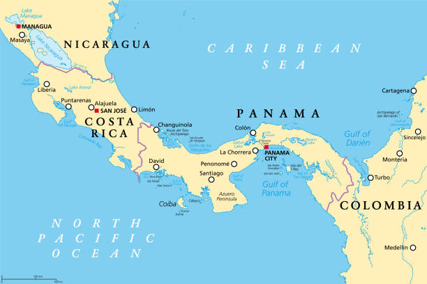
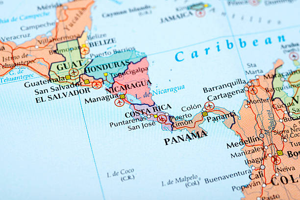
Costa Rica and Panama, political map, with the Isthmus of Panama and the Darien Gap. Narrow strip of land and region between the Caribbean Sea and the Pacific Ocean, linking North and South America.

Highly detailed physical map of the Colombia,in vector format,with all the relief forms,regions and big cities.

Colombia map Earth I have used http://legacy.lib.utexas.edu/maps/world_maps/world_physical_2015.pdf http://legacy.lib.utexas.edu/maps/americas/colombia_physio-2008.jpg address as the reference to draw the basic map outlines with Illustrator CS5 software, other themes were created by myself.

Colombia map Earth I have used http://legacy.lib.utexas.edu/maps/world_maps/world_physical_2015.pdf http://legacy.lib.utexas.edu/maps/americas/colombia_physio-2008.jpg address as the reference to draw the basic map outlines with Illustrator CS5 software, other themes were created by myself.
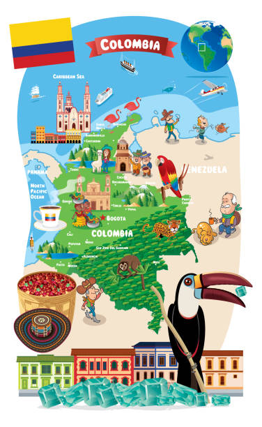
Cartoon map of Colombia Earth I have used http://legacy.lib.utexas.edu/maps/world_maps/world_physical_2015.pdf http://legacy.lib.utexas.edu/maps/americas/colombia_physio-2008.jpg address as the reference to draw the basic map outlines with Illustrator CS5 software, other themes were created by myself.

http://dikobraz.org/map.jpg

Detailed map of Colombia with navigation icons.

Map of Colombia - Highly Detailed Vector illustration
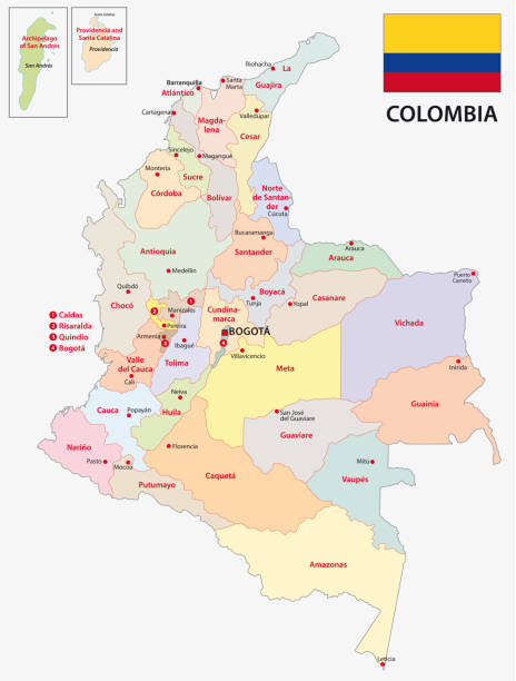
colombia administrative and political map with flag

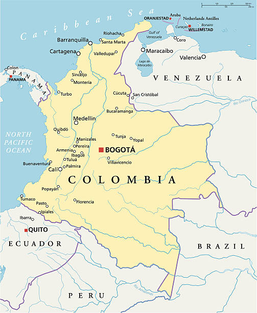
Colombia Travel Map https://maps.lib.utexas.edu/maps/americas/colombia_physio-2008.jpg
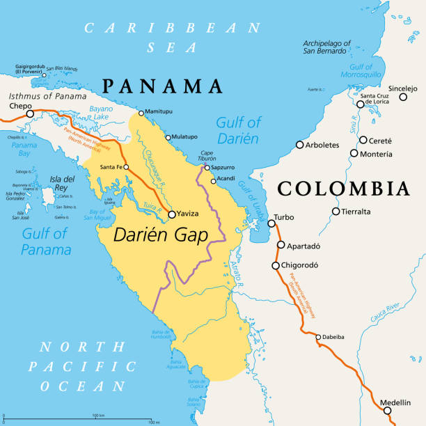
Darien Gap, political map. Geographical region in the Isthmus of Panama, connecting North and South America with Central America. The gap is in the Pan-American Highway of which a part were not built.

Darien Gap, gray political map. Region in the Isthmus of Panama, connecting North and South America with Central America. The gap is in the Pan-American Highway of which a part were not built.

Detailed Vector Map of Colombia.

Colombia map and flag - High Detailed Vector Illustration

Map of Colombia - Highly Detailed Vector illustration

Detailed map of Columbia.

Map of Colombia - Vector illustration

Colombia political map with capital Bogota, national borders and neighbors. Republic and transcontinental country in Central and South America. Gray illustration over white. English labeling. Vector.

Detailed map of Colombia with pointers.

Colombia map and flag - High Detailed Vector Illustration

Map of countries on an old dusty globe against a white-isolated backdrop.

Cartoon map of Colombia Earth I have used http://legacy.lib.utexas.edu/maps/world_maps/world_physical_2015.pdf http://legacy.lib.utexas.edu/maps/americas/colombia_physio-2008.jpg address as the reference to draw the basic map outlines with Illustrator CS5 software, other themes were created by myself.

Detailed map of Colombia.

Colombia administrative and political vector map

Map of Colombia - Vintage Vector illustration

Vector Colombian Symbols

Hand painted water color drawing on white background, cut out clip art elements for design.

Costa Rica and Panama, gray political map, with the Isthmus of Panama and the Darien Gap. Narrow strip of land and region between the Caribbean Sea and Pacific Ocean, linking North and South America.

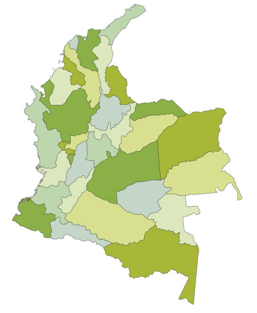
Country Political Geographical Map of Colombia with Departments with Shadows

Map of Colombia - Infographic Vector illustration

Vector Happy New Year Colombia http://legacy.lib.utexas.edu/maps/world_maps/world_physical_2015.pdf

Cartoon map of Colombia Earth I have used http://legacy.lib.utexas.edu/maps/world_maps/world_physical_2015.pdf http://legacy.lib.utexas.edu/maps/americas/colombia_physio-2008.jpg address as the reference to draw the basic map outlines with Illustrator CS5 software, other themes were created by myself.

Cartoon map of Colombia Earth I have used http://legacy.lib.utexas.edu/maps/world_maps/world_physical_2015.pdf http://legacy.lib.utexas.edu/maps/americas/colombia_physio-2008.jpg address as the reference to draw the basic map outlines with Illustrator CS5 software, other themes were created by myself.

Map of Colombia - Vintage Vector illustration

Map of Colombia - Vector illustration

Colombia map and flag - High Detailed Vector Illustration

Colombia - vintage map and flag - High Detailed Vector Illustration
© 2025 iStockphoto LP. The iStock design is a trademark of iStockphoto LP. Browse millions of high-quality stock photos, illustrations, and videos.
Do Not Sell or Share