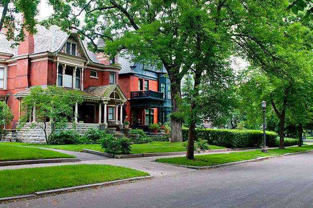
Homes in an quiet urban neighborhood in St. Paul, Minnesota.
Browse 1,500+ saint paul street stock photos and images available, or start a new search to explore more stock photos and images.
Homes in an quiet urban neighborhood in St. Paul, Minnesota.
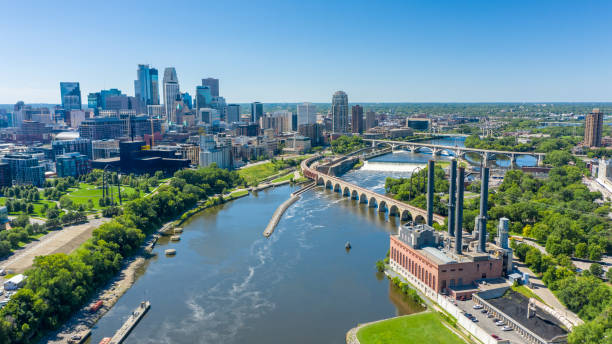
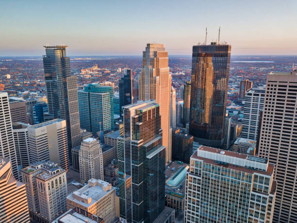
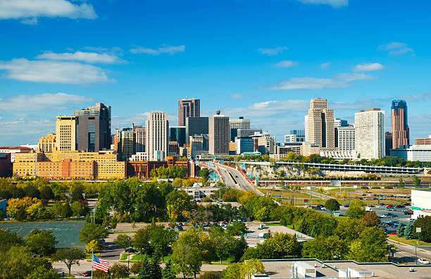
Aerial view of downtown Minneapolis over the Mississippi River.
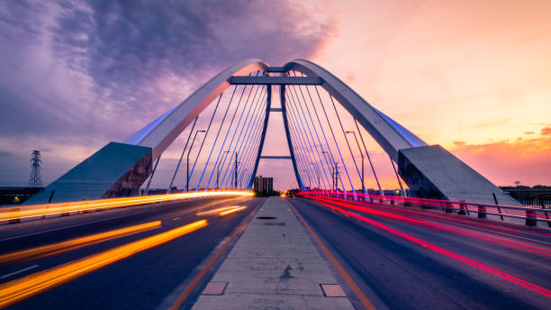
car trails at lowry bridge in minneapolis at sunset

Poster Style Topographic / Road map of St. Paul, MN. Map data is public domain via census.gov. All maps are layered and easy to edit. Roads are editable stroke.

Wabash Avenue Bridge, Chicago, Illinois, USA
Cityscape urban skyline of St. Paul, Minnesota, USA, a state capital city. The downtown district features the Mississippi River in the foreground. The Midwest metropolis has architecture of skyscrapers, office buildings and other built structures. Boats and barges navigate the waterway for nautical commerce. Summer blue sky provides copy space.
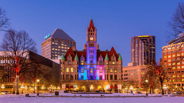
Daytime graces the St. Paul skyline.

This fantastic view from above of St Paul in Minnesota under a cloudy sky.

Aerial view of houses in Maple Grove, a suburban city in the Minneapolis-St. Paul metro area, Hennepin County, Minnesota, on an overcast day in Fall.
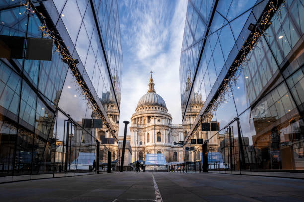
Commuters crossing the Millenium Bridge walking towards St Pauls Cathedral

Aerial still image of Wabasha Street Bridge and Robert Street Bridge on Mississippi River at sunset. Authorization was obtained from the FAA for this operation in restricted airspace.

Aerial view of houses in Maple Grove, a suburban city in the Minneapolis-St. Paul metro area, Hennepin County, Minnesota, on an overcast day in Fall.

Munich, Germany - September 22: Participants of the annual opening parade called "einzug der wirte" of the oktoberfest on september 22, 2018 in the old town of munich

St. Paul Skyline at Dusk in the Winter with Light Trials

Photo taken from the top outside balcony of the Minnesota State Capitol.
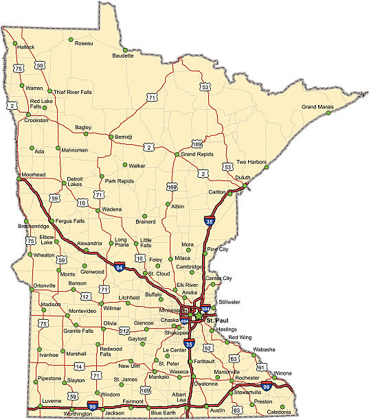
Highway map of the state of Minnesota with Interstates and US Routes. It also has lines for state and county routes (but not labeled) and many cities on it as well. All cities are the County Seats and the Capitol (and some others).

Dallas, USA - June 7, 2019: Downtown cityscape modern buildings streetscape in city near Klyde Warren park with sign for Museum of Art on north St. Paul Street

Pointe-à-Pitre, Guadeloupe: Saint-Pierre-et-Saint-Paul church, completed in 1817 to a design by the architect Nicolas Nassau - in the 1843 earthquake the building suffered substantial damage, the long reconstruction only completed in the 1870s employed a metal structure made in mainland France by Maison Joly in Argenteuil, the church was a pioneer in the use of iron for religious buildings in the French colonies - Place Gourbeyre.
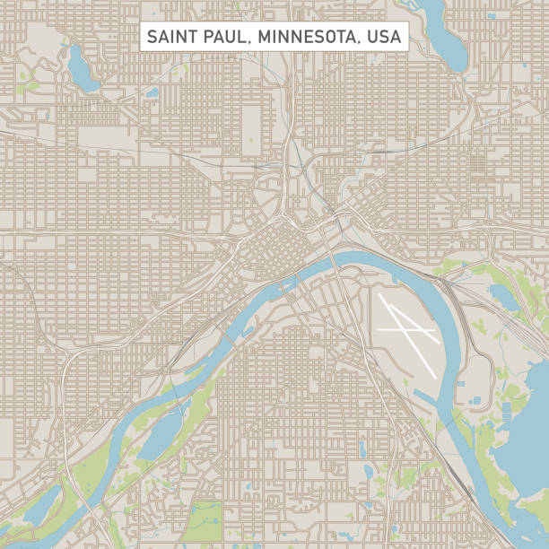
Vector Illustration of a City Street Map of Saint Paul, Minnesota, USA. Scale 1:60,000. All source data is in the public domain. U.S. Geological Survey, US Topo Used Layers: USGS The National Map: National Hydrography Dataset (NHD) USGS The National Map: National Transportation Dataset (NTD)

Skyline of St, Paul in Minnesota, USA

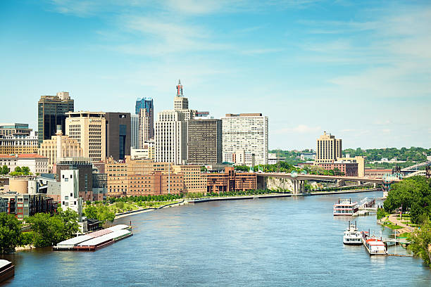
Subject: The city skyline of St. Paul Minnesota viewed from the Mississippi River with the High Bridge in the foreground.
Macao,China AUG,25.2021 Ruins Of Saint Paul's Cathedral. Built from 1582 to 1602 by the Jesuits. Was destroyed by a fire during a typhoon in 1835.

Tunis, Tunisia - August 29, 2007. The catholic Cathedral of St Vincent de Paul at the Place de l'Independence in the Ville Nouvelle. Street life in sunny day.
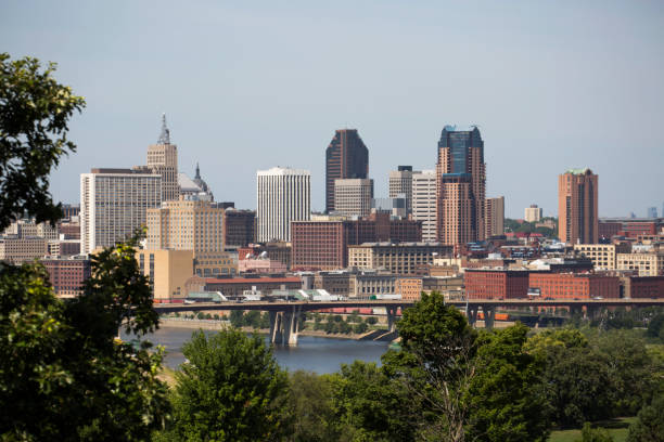
"Downtown Saint Paul, MN skyline with trees in the foreground and a blue sky with clouds in the background. St. Paul is part of the Twin Cities Minneapolis - Saint Paul metropolitan area."

Saint Paul MN City Vector Road Map Blue Text. All source data is in the public domain. U.S. Census Bureau Census Tiger. Used Layers: areawater, linearwater, roads.

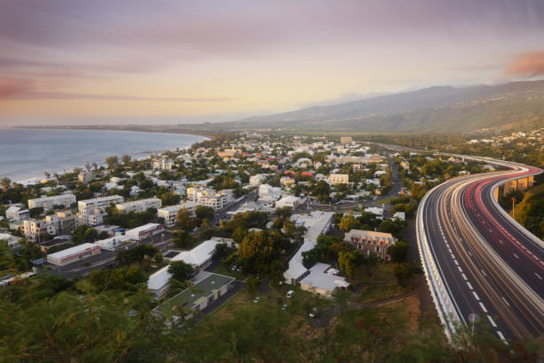
Amazing fireworks over light trails of cars on the tamarin road in Saint Paul, Reunion Island

Paris, typical facade in the Marais, beautiful building

Cathedral of St. Paul, Minnesota in the morning

Aerial still image of train crossing Mississippi River from downtown St. Paul, Minnesota at twilight in Fall. Authorization was obtained from the FAA for this operation in restricted airspace.

Paris, view of the quai de Bethune on the ile Saint-Louis, panorama of the roofs, with the Saint-Paul church in background

Aerial still image of downtown St. Paul, Minnesota, with Raspberry Island and Mississippi River in front. Authorization was obtained from the FAA for this operation in restricted airspace.

Minneapolis, MN, USA May 14, 2013 The honor guard salutes the police officers killed in the line of duty in Minneapolis, Minnesota

Esplanade of the city of Valladolid with the monumental church of San Pablo, Castilla Leon

Bonsecours Market in Montreal is located on cobblestoned historic St. Paul Street in Old Montreal. It is a public market and is also available as a public banquet hall.

Rome, Italy - October 8, 2022: The Pyramid of Caius Cestius or Piramide Cestia and Porta San Paolo Gate in Ostiense quartier. Rome, Italy.

The City skyline of the city of St. Paul. The capitol city of the state of Minnesota, USA. The business and financial of downtown St. Paul in front of the Mississippi River.
Holy Saint Paul Cathedral reflection
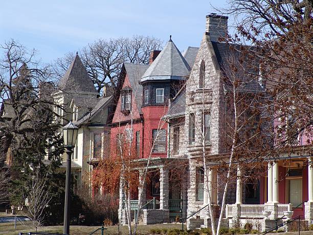
"Colorful homes on Summit Avenue, Saint Paul, MN. Please CLICK on Lightbox Button Below to see more images of HOMES OLD AND NEW"

City of London in black and white.

Spring Sunset in Downtown Minneapolis - Minnesota - USA

"St. Paul, Minnesota residential neighborhood"

Lublin, Poland. Church of Saints Peter and Paul. Capuchin Order. Lithuanian squareLublin, Poland. Church of Saints Peter and Paul. Capuchin Order. Lithuanian square or Krakowskie Przedmiescie

"Subject: The city of St. Paul Minnesota with the Mississippi River in the foregroundLocation: St. Paul, Minnesota, USA"

Macao,China AUG,25.2021 Ruins Of Saint Paul's Cathedral. Built from 1582 to 1602 by the Jesuits. Was destroyed by a fire during a typhoon in 1835.

African American boy playing in the snow in front of a house. He has snow shoes on and the morning sun is shining behind him. He took a handful of snow and threw it on the air. The photo showed that he was smiling and having fun. The photo was taken after days of snow blizzard in Saint Paul, Minnesota.

Panorama of St. Paul. St. Paul, Minnesota, USA.

Street in the small village of Saint Paul De Vence

Athens, Greece - April 4 2015: View of Apostolou Pavlou St, the pedestrian zone that goes around the Acropolis Hill, at Thiseio district. Flea market, incidental people.
© 2025 iStockphoto LP. The iStock design is a trademark of iStockphoto LP. Browse millions of high-quality stock photos, illustrations, and videos.
Do Not Sell or Share