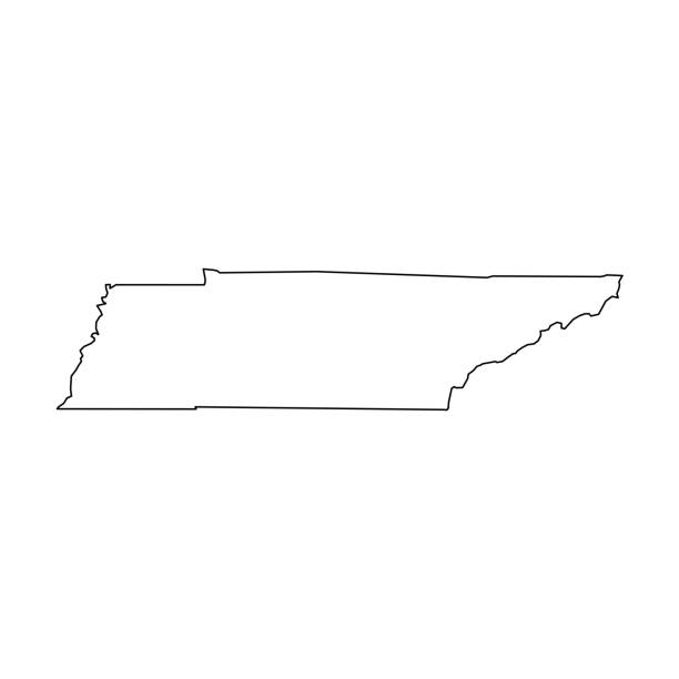
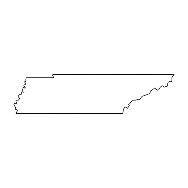
Tennessee state map. US state map. Tennessee silhouette symbol. Vector illustration
Browse 2,700+ tennessee state stock photos and images available, or search for tennessee state capitol or tennessee state flag to find more great stock photos and pictures.
Tennessee state map. US state map. Tennessee silhouette symbol. Vector illustration

Nashville, Tennessee, USA downtown skyline on the Cumberland River.
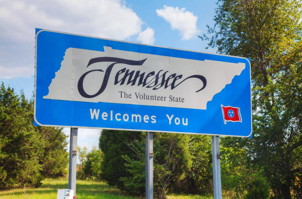
Tennessee welcomes you sign at he state border
Tennessee, state of USA - solid black outline map of country area. Simple flat vector illustration.
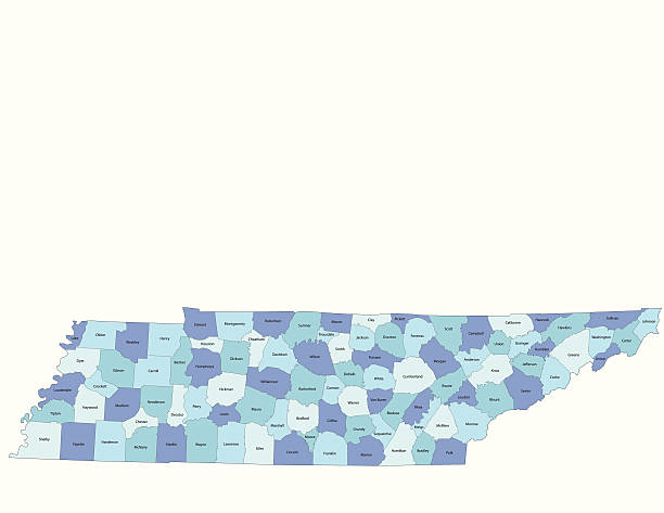
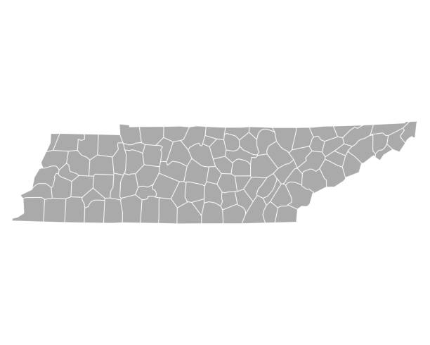
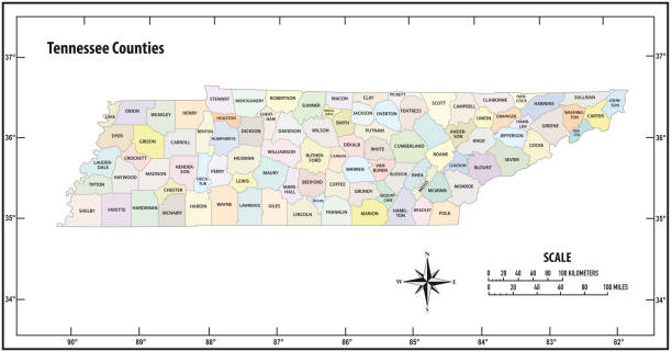
Detailed state-county map of Tennessee. This file is part of a series of state/county maps. Each file is constructed using multiple layers including county borders, county names, and a highly detailed state silhouette. Each file is fully customizable with the ability to change the color of individual counties to suit your needs. Zip contains both .AI_CS2 and .ESP_8.0 as well as a large JPEG file. Map generated using data from the public domain. (http://www.census.gov/geo/www/tiger/) Traced using Adobe Illustrator CS2 on 7/28/2006. 3 data layers.
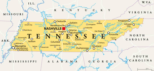
Tennessee, TN, political map, with capital Nashville, largest cities, lakes and rivers. State of Tennessee. Landlocked state in Southeastern region of the United States, nicknamed The Volunteer State.

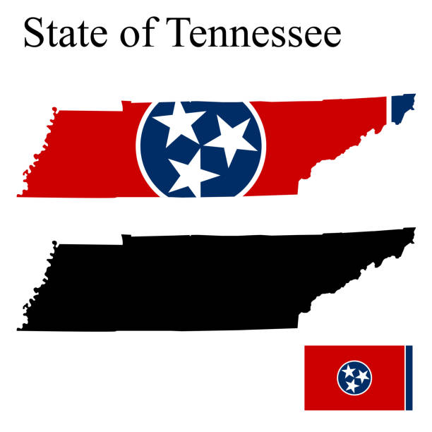
Flag of the US State of Tennessee, detailed vector.

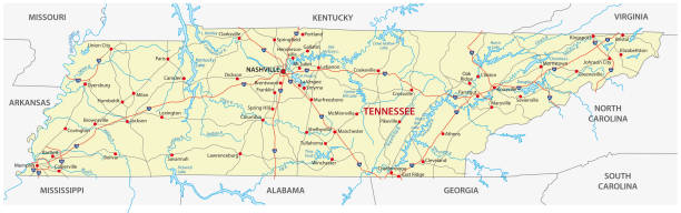
A detailed map of Tennessee state with cities, roads, major rivers, national forests and lakes. Includes neighboring states and surrounding water.

map of the U.S. state of Tennessee

vector of the Tennessee map

Nashville Tennessee downtown skyline at Shelby Street Bridge

Sunset from Grassy Ridge overlooking the other Roan Balds, Jane Bald, Round Bald, Roan high knob. It was a very colorful sunset with the Rhododenrons blooming this week.

vector illustration of Tennessee map

3d isometric Map of Tennessee is a state of United States with national flag
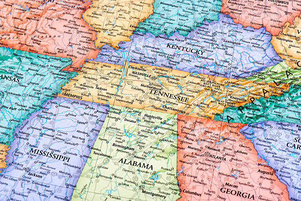
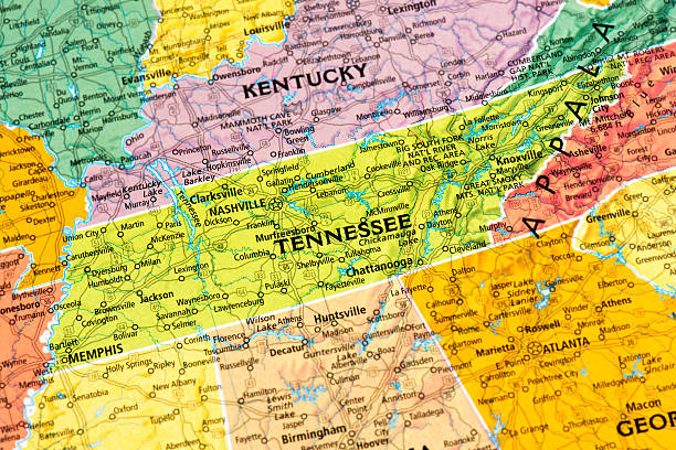
Map of Tennessee and Kentucky States in USA. Detail from the World Map.
Line USA state, American map illustration, America vector isolated on white background, outline style

illustration of highly detailed U.S.A map with all state for your design , products and print.
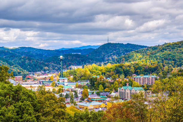
Gatlinburg, Tennessee, USA town skyline in the Smoky Mountains.
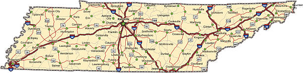
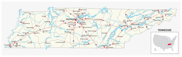
Highway map of the state of Tennessee with Interstates, US Routes and state routes. It also has lines for other major roads (but not labeled). It has many cities and the State Capitol on it.
tennessee road vector map

Tennessee. Vector silhouette state. Tennessee map with text script. Tennessee shape state map for poster, t-shirt, tee, souvenir. Vector outline Isolated illustratuon on a white background.
![US capital cities on map series: Nashville, TN [url=/file_search.php?action=file&lightboxID=11838152#e650b4d][img]http://farm8.staticflickr.com/7189/6818724910_54c206caf8.jpg[/img][/url] tennessee state stock pictures, royalty-free photos & images](https://media.istockphoto.com/id/181852125/photo/us-capital-cities-on-map-series-nashville-tn.jpg?s=612x612&w=0&k=20&c=cLMSuVgdB-JtxgT7XlqcFe_HpbjGKNMpaJyloYTWU8w=)
[url=/file_search.php?action=file&lightboxID=11838152#e650b4d][img]http://farm8.staticflickr.com/7189/6818724910_54c206caf8.jpg[/img][/url]
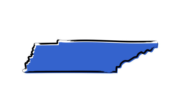
Stylized blue sketch map of Tennessee on white background
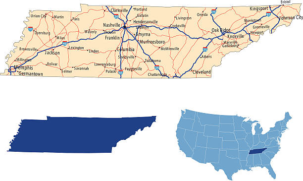
illustration of Tennessee state road map for your design and products.
Set of maps of Tennessee (USA). Flag on the map. Silhouette of the card. Vector illustration

A vertical drone shot of the square in Franklin Downtown in Tennessee, USA

Nashville, Tennessee, USA- 09/16/2022: Nashville city panorama
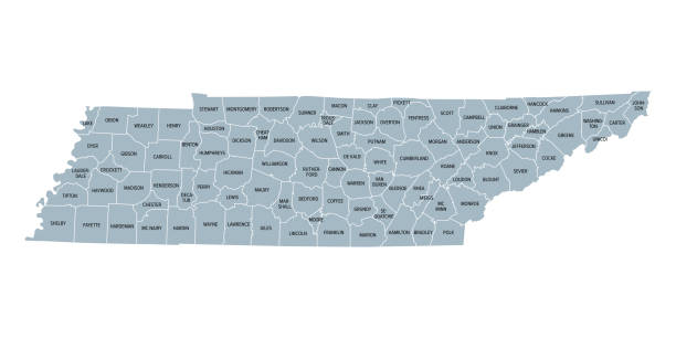
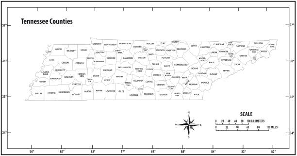
Tennessee, subdivided into 95 counties, gray political map with borders and county names. Landlocked state in the Southeastern region of the United States, nicknamed The Volunteer State. Illustration

Detailed outline map of Tennessee with capital

A welcome sign at the Tennessee state line.
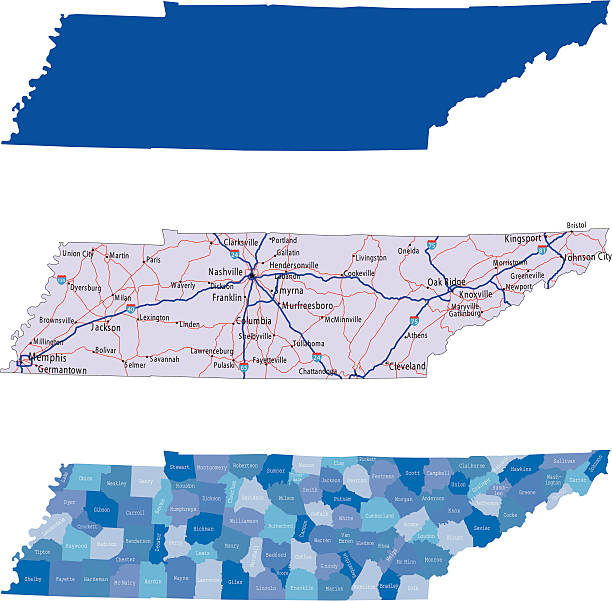
illustration of Tennessee state map with road map for your design and products.

vector illustration of Tennessee flag

http://farm8.staticflickr.com/7189/6818724910_54c206caf8.jpg

Vector silhouette of Tennessee in white with a drop shadow.

The pillars and building of Tennessee state house in nashville

Vector illustration of Tennessee state, contains:

Tennessee Flag on Courthouse, taken with lensbabies

The spring rhododenron blooms at grassy ridge in the Roan Highlands of the Blue Ridge Mountains were spectacular this year.

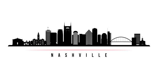
Label or sign with name of Nashville, Tennessee, USA, vector illustration
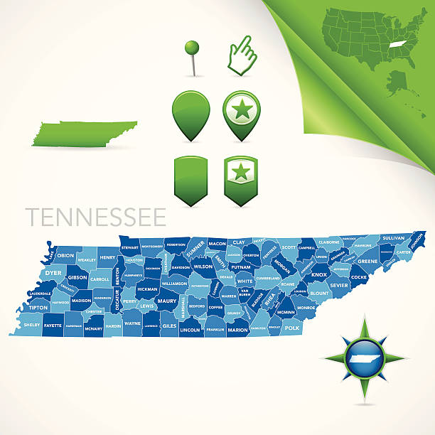
Highly-detailed Tennessee county map. Each county is in it's own separate labeled layer. County names are in a separate layer and can be easily adjusted or removed as well. All layers have been alphabetized for easy manipulation, recoloring or other use.
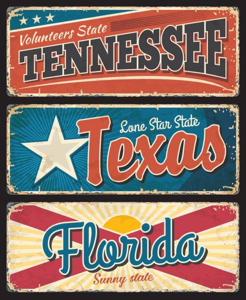
Tennessee, Texas and Florida states rusty metal plates. USA states old, shabby signs, signboards with flag stars and stripes, retro typography, inscriptions and rusty scratches texture vector

Stylized red sketch map of Tennessee illustration vector
© 2025 iStockphoto LP. The iStock design is a trademark of iStockphoto LP. Browse millions of high-quality stock photos, illustrations, and videos.
Do Not Sell or Share